Tring, Northchurch and Berkhamsted Urban Transport Plan: Speed Management B4635
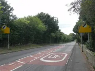
Aylesbury Road (B4635) is one of the two main routes into Tring from the A41 bypass. The other main route is the London Road (B4635), the main southern route into Tring from the A41 bypass. At the entrance to Tring for both these routes, the speed limit reduces from the National Speed Limit to 30mph. Speeding is an issue along this road as vehicles do not not slow down before the residential areas.
Examination of data warrants the provision of further speed management.
Speed management is required for both these approach roads The introduction of a 40mph buffer zone is required as the immediate reduction from National Speed Limit to 30mph is not effective. Recent accident data suggests that reducing the approach speed at the turn adjacent to the cemetery should reduce the risks.
Rumble Strips - Intended to alert drivers to take greater care in advance of hazard or junction are suggested for the London Road at the entrance to the existing 30mph zone since there are hazards located along this road, ie local schools and the supermarket access roundabout .
Additionally, there are no dedicated cycle facilities provided on the Aylesbury Road between the Icknield Way roundabout to the north and 30mph commencement to the south. Provision of a shared use footway on the Aylesbury Road to link to the existing segregated cycle zone at the Ickfield Way roundabout into Tring town centre - this would involve some widening of the footway. On the north side of the road, the footway narrows about 350m from the roundabout so cyclists would be obliged to cross to the southern side to link with the shared facility, this again would require some widening of the footway. The shared use footway would continue for approximately 450m where cyclists would be diverted onto the carriageway towards the town centre.
The B488 Icknield Way is the main northern through route from the A41 Bypass into Bulbourne and Church End. Due to the location of Tring Industrial Estate and residential areas fronting onto Icknield Way, this route carries a high level of both strategic and local traffic. Speeding is an issue along this route as vehicles don't slow down before the residential areas of Tring.
County Councillor Nick Hollinghurst, Tring and the Villages, has recently authorised expenditure on a preliminary vehicle speed survey near the Industrial Estate.
'Ripple Print' is proposed within the 30mph zone north of Longbridge Close and southwest of Icknield Green. Ripple Print is a gentle corrugation 'printed' on the road surface which combines the benefits of a rumble strip without the associated noise to nearby residents. Internal noise and vibration are retained within a vehicle, but external noise is low.
(Scheme Proforma's 28, 32 and 35 refer in more detail)
https://consult.hertsdirect.org/tringberkhamstedutp/assets/documents/volume-2-part-9-proforma-26
https://consult.hertsdirect.org/tringberkhamstedutp/assets/documents/volume-2-part-10-proforma-3