Tring, Northchurch and Berkhamsted Urban Transport Plan: Improving Footways and Crossings
The Urban Transport Plan has as its basis the need to promote, implement and support a series of smarter measures to encourage the use of sustainable alternatives to private car travel for residents and visitors. This is achieved by providing the necessary infrastructures and services to enable people to make informed travel choices. However, education and promotion of the alternatives to car travel will also play a part in the overall scheme.
Influencing people's travel behaviour requires a holistic approach as opposed to implementing individual interventions in isolation. This involves making the best use of the existing infrastructure with low cost, high value improvements.
The key objectives:
- Promote active travel modes to encourage active and healthy lifestyles;
- Reduce congestion in traffic hotspots;
- Improve connectivity within and between towns through a network of walking and cycling facilities.
Footpath 41 is located parallel to Brook Street in Tring and provides access to the Town Centre. There is currently no crossing facility on Silk Mill Way or on Brook Street, where speeding is an issue, from Shugars Green to Silk Mill Way.
A zebra crossing at Brook Street would improve access for pedestrians and, just as importantly it would improve driver awareness of the pedestrians.
Silk Mill Way dissects Footpath 41 and in order to provide a continuous pedestrian route through Tring, it is proposed to site another zebra crossing at this point which will also allow safe access to the bus stops located there.
It is also proposed that the footpath is upgraded to allow shared use by pedestrians and cyclists.
Footway 39, which is the route between Tring School on Mortimer Hill and Tesco on London Road, is well used, especially by school children at lunch time. The proposal is to provide an uncontrolled crossing adjacent to the mini-roundabout, at the location of the existing splitter island and widen the footway.
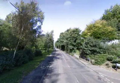
There is a high level of use between Pound Meadow and Dunsley Farm, and its Farm Shop. So it is proposed that a 2m footway is introduced along this section.
Footway 48: Miswell Lane separates the residential areas of Tring and forms a key crossing point for Tring town centre. Pupils to Goldfield Infant School use Footway 48 as they travel from Highfield Road. So another pedestrian crossing is proposed due to the levels of traffic using this route and the high incidence of speeding ,where there is currently dropped kerbs on either side of Miswell Lane. There are also plans to upgrade the Footway to permit access for cyclists as well as pedestrians.
In addition there is a proposal to improve the pedestrian access along Icknield Way from Miswell Lane into Tring Industrial Estate